| Products / Mapping Handhelds / eTrex Legend H
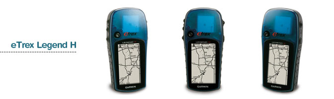
eTrex Legend: Puts the great outdoors in the palm of your hand.
The brightly-colored eTrex Legend combines all of the intuitive, user-friendly features of the eTrex series with a full basemap of the Americas, the Atlantic or the Pacific and 8 megabytes (MB) of internal memory for storing optional maps.
Pinpoint Your Location
The Legend can receive position corrections from the Wide Area Augmentation System (WAAS), which makes Legend's already-accurate positioning data even more reliable. In fact, when you turn on WAAS, you can increase the accuracy of Legend's position reporting to within three meters.
Add More Detail
The Legend's basemap contains lakes, rivers, cities, interstates, national and state highways, railroads and coastlines. Legend also comes preloaded with marine navigation aids. And, with Legend's 8 MB of memory, you can add even more map detail with data from Garmin's entire line of MapSource® mapping products.
Physical & Performance |
| Unit dimensions, WxHxD: |
2.0" x 4.4" x 1.2" (5.1 x 11.2 x 3.0 cm) |
| Display size, WxH: |
1.1" x 2.1" (2.8 x 5.4 cm) |
| Display resolution, WxH: |
160 x 288 pixels |
| Display type: |
4 level gray LCD |
| Weight: |
5.3 oz (150 g) with batteries |
| Battery: |
2 AA batteries (not included) |
| Battery life: |
18 hours |
| Waterproof: |
yes (IPX7) |
| Floats: |
no |
| High-sensitivity receiver: |
yes |
| Interface: |
USB |
| RoHS version available: |
yes |
Maps & Memory |
| Basemap: |
yes |
| Preloaded street maps: |
no |
| Ability to add maps: |
yes |
| Built-in memory: |
24 MB |
| Accepts data cards: |
no |
| Waypoints/favorites/locations: |
1000 |
| Routes: |
20 |
| Track log: |
10,000 points, 10 saved tracks |
Features |
| Automatic routing (turn by turn routing on roads): |
no |
| Electronic compass: |
yes |
| Touchscreen: |
no |
| Barometric altimeter: |
yes |
| Geocaching-friendly: |
yes |
| Outdoor GPS games: |
yes |
| Hunt/fish calendar: |
yes |
| Sun and moon information: |
yes |
| Tide tables: |
no |
| Area calculation: |
yes |
| Custom POIs (ability to add additional points of interest): |
no |
| Unit-to-unit transfer (shares data wirelessly with similar units): |
no |
| Picture viewer: |
no |
|
|
|
|