| Products / Mapping Handhelds/ Edge 500

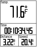
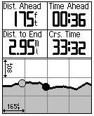
Sharpen your cycling performance with Edge 500, a lightweight GPS-based cycling computer for performance-driven cyclists. Loaded with data, Edge 500 tracks your distance, speed, location and elevation with high sensitivity GPS. Add an ANT + ™ compatible heart rate monitor, speed / cadence sensor or compatible power meter for a finely-tuned analysis of your ride.
Jumpstart Your Training
The Edge 500 attaches easily to the stem or handlebars of your bike with its low-profile bike mount. The Edge attaches easily to the mount with a simple quarter-turn. When you're ready to ride, just power on your Edge, acquire GPS satellites and go. Edge 500 features a high-sensitivity GPS receiver with HotFix ™ satellite prediction to calculate your position faster.
Track Your Heart Rate
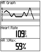
When paired with a Garmin heart rate monitor, Edge 500 tracks heart beats per minute and uses your heart rate for advanced computation calorie, so you know how many calories you're burning. Train in A Certain heart-rate zone to improve your fitness level or compare your pace and heart rate to past performance over the same ride.
Analyze Your Ride
Once your ride's done, Edge 500 to connect your computer with the included USB cable to analyze your performance. With a simple click, you can join a worldwide network of cyclists and outdoor enthusiasts through Garmin Connect™, a one-stop site for data analysis and sharing.
Physical & Performance: |
| Unit dimensions, WxHxD: |
1.9 "x 2.7" x 0.85 "(4.8 x 6.9 x 2.2 cm) |
| Display size, WxH: |
1.17 "x 1.44" (3.0 x 3.7 cm) |
| Display resolution, WxH: |
128 x 160 pixels |
| Display type: |
4 level gray LCD |
| Weight: |
2 oz (56.7 g) |
| Battery: |
rechargeable lithium-ion |
| Battery life: |
up to 18 hours |
| Waterproof: |
yes (IPX7) |
| Floats: |
no |
| High-sensitivity receiver: |
yes |
| Interface: |
serial and USB |
| RoHS version available: |
yes |
Maps & Memory: |
| Basemap: |
no |
| Preloaded street maps: |
no |
| Ability to add maps: |
no |
| Built-in memory: |
1 MB |
| Accepts data cards: |
no |
| Waypoints/favorites/locations: |
0 |
| Routes: |
0 |
| Track log: |
Limited by memory space available |
Features: |
| Automatic routing (turn by turn routing on roads): |
no |
| Electronic compass: |
no |
| Barometric altimeter: |
yes |
| Geocaching-friendly: |
yes |
| Outdoor GPS games: |
yes |
| Sun and moon information: |
yes |
| Tide tables: |
no |
| Area calculation: |
yes |
| Custom POIs (ability to add additional points of interest): |
no |
| Unit-to-unit transfer (shares data wirelessly with similar units): |
no |
| Picture viewer: |
no |
|
|
|
|

