| Products / Mapping Handhelds / marine420-420s
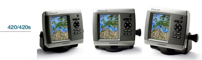
The GPSMAP 420 is a sleek, space-saving chartplotter that features an ultra-bright 4” QVGA display; built-in, satellite-enhanced worldwide basemap and simplified user operation. The 420 also has an SD™ card slot so you can add additional features with the optional BlueChart® g2 Vision card.
View Satellite-enhanced Maps
The 420’s basemap contains worldwide satellite images in place of more traditional maps, and its SD card slot makes it easy to add additional maps without connecting to a computer. With fewer keys and a simple, intuitive interface, the 420 makes navigating your way through the water easy.
Add Sonar
Where applicable, the sounder version, GPSMAP 420s, comes with a powerful dual frequency transducer that clearly paints depth contours, fish targets and structure whether you’re fishing in freshwater or off the coast. The 420 and 420s are also CANet™ compatible, so you can share sounder data with another chartplotter on your boat.
Add Extras with BlueChart g2 Vision
With the optional BlueChart g2 Vision SD card, you can add a whole new dimension of exceptional features to your chartplotter.
- MarinerEye view and FishEye view provide you a 3-dimensional perspective of map information, both above and below the waterline.
- High-resolution satellite images and aerial photographs help you orient yourself in unfamiliar areas.
- Auto Guidance technology searches through all relevant charts to create a route you can actually follow — one that avoids obstacles, shallow water, buoys and other obstructions.
For a low cost option try BlueChart g2 cards.
Physical & Performance: |
| Unit dimensions, WxHxD: |
5.7" x 5.0" x 2.7" (14.5 x 12.7 x 6.9 cm) |
| Display size, WxH: |
2.4" x 3.2", 4.0" diagonal (6.1 x 8.1 cm, 10.2 cm diagonal) |
| Display resolution, WxH: |
240 x 320 pixels |
| Display type: |
QVGA |
| Weight: |
1.3 lb (590 g) |
| Battery: |
none |
| Battery life: |
none |
| Waterproof: |
yes (IPX7) |
| Floats: |
no |
| High-sensitivity receiver: |
no |
| Interface: |
serial and USB |
| RoHS version available: |
yes |
Maps & Memory: |
| Basemap: |
yes |
| Preloaded street maps: |
no |
| Ability to add maps: |
yes |
| Built-in memory: |
none (cannot load maps to internal memory) |
| Accepts data cards: |
SD™ card slot |
| Waypoints/favorites/locations: |
1,500 |
| Routes: |
20 |
| Track log: |
10,000 points; 20 saved tracks |
Features: |
| Automatic routing (turn by turn routing on roads): |
no |
| Electronic compass: |
no |
| Barometric altimeter: |
no |
| Geocaching-friendly: |
yes |
| Outdoor GPS games: |
yes |
| Sun and moon information: |
yes |
| Tide tables: |
yes |
| Area calculation: |
yes |
| Custom POIs (ability to add additional points of interest): |
no |
| Unit-to-unit transfer (shares data wirelessly with similar units): |
no |
| Picture viewer: |
no |
|
|
|
|